Global LiDAR Software Market Size is valued at USD 488.6 Mn in 2024 and is predicted to reach USD 3050.3 Mn by the year 2034 at a 20.2% CAGR during the forecast period for 2025-2034.
The light detection and ranging (LiDAR) system is generalized as a remote sensing device that uses light beams to analyze, detect, and map things. The LiDAR device consists of a sender that emits light rays and a receiver that gathers reflected light rays for mapping purposes. Due to its capacity to generate highly accurate data and 3D photos in less time than traditional surveying methods, this technology has gained appeal over conventional surveying methods. The improved automated processing capability of LiDAR scanners and systems in terms of picture resolution and prompt data processing capability over other technologies are the primary factors pushing the growth of the global LiDAR market.
However, the COVID-19 pandemic has significantly influenced the LiDAR ecosystem's enterprises. Both producers and end users have benefited from LiDAR technology. The epidemic of COVID-19 has had a significant impact on the market for oil and gas exploration applications. LiDAR exploration applications include using LiDAR for oil and gas exploration and mining. The restrictions on public transit reduced gasoline use and had an impact on global oil prices. The decrease in oil and gas output has impacted exploratory applications, reducing the market for LiDAR.
The LiDAR Software Market is segmented on the basis of application, technology type, product type, and deployment. Application segment includes forestry & environmental, survey & mapping, automotive, construction & infrastructure, and others. The technology type segment includes mechanical and solid states. The market is segmented by product type into simulation, mapping, and processing software. The deployment segment includes airborne and terrestrial.
The airborne category is expected to hold a major share of the global LiDAR Software Market in 2022. The segment's growth is likely to continue in the next years, owing to the increased deployment of aerial mapping technologies. The airborne LiDAR system is a precise and comprehensive means of constructing digital elevation models, effectively replacing photogrammetry. This technology covers a larger area than its terrestrial counterparts and provides broad area mapping in shorter time intervals.
The personal care segment is projected to grow at a rapid rate in the global LiDAR Software Market. The increased need for LiDAR systems in applications such as ADAS and driverless vehicles drives this segment's growth. Emerging LiDAR technologies widely employed in the automotive sector include driver assistance and low-speed collision avoidance systems. These technologies provide greater monitoring and guidance features to the driver, allowing self-driving cars to succeed even without a human driver.
The North America LiDAR Software Market is expected to register the highest market share in terms of revenue in the near future. This can be due to the region's increasing acceptance of administrative regulations demanding the installation of specified automotive safety technologies in both lightweight and heavyweight vehicles. Because of the increased acceptance of technology such as ADAS and AEB, North America has seen growth potential in the automobile business. Because of increased local and foreign investment, China and India are projected to remain lucrative markets. To improve client service, the corporations are growing their presence in Europe and Asia Pacific.
| Report Attribute | Specifications |
| Market size value in 2024 | USD 488.6 Mn |
| Revenue forecast in 2034 | USD 3050.3 Mn |
| Growth rate CAGR | CAGR of 20.2% from 2025 to 2034 |
| Quantitative units | Representation of revenue in US$ Mn, and CAGR from 2025 to 2034 |
| Historic Year | 2021 to 2024 |
| Forecast Year | 2025-2034 |
| Report coverage | The forecast of revenue, the position of the company, the competitive market statistics, growth prospects, and trends |
| Segments covered | Application, Technology Type, Product Type, And Deployment |
| Regional scope | North America; Europe; Asia Pacific; Latin America; Middle East & Africa |
| Country scope | U.S.; Canada; U.K.; Germany; China; India; Japan; Brazil; Mexico; The UK; France; Italy; Spain; China; Japan; India; South Korea; Southeast Asia; South Korea; Southeast Asia |
| Competitive Landscape | Phoenix LiDAR Systems, Terrasolid, GreenValley International, Routescene, YellowScan, LeddarTech Inc., Blickfeld GmbH, Teledyne Geospatial, Velodyne LiDAR, Inc., Innoviz Technologies Ltd, Shanghai Huace Navigation Technology Ltd. (CHC Navigation), Geo-Plus, GeoCue, Leica Geosystems AG - Part of Hexagon AB, Quanergy Systems, Inc., Seoul Robotics, Neuvition, Inc., MatrixSpace, Aeva Inc., and Outsight SA. |
| Customization scope | Free customization report with the procurement of the report, Modifications to the regional and segment scope. Particular Geographic competitive landscape. |
| Pricing and available payment methods | Explore pricing alternatives that are customized to your particular study requirements. |
LiDAR Software Market By Application-
LiDAR Software Market By Technology Type-
LiDAR Software Market By Product Type-
LiDAR Software Market By Deployment-
LiDAR Software Market By Region-
North America-
Europe-
Asia-Pacific-
Latin America-
Middle East & Africa-
This study employed a multi-step, mixed-method research approach that integrates:
This approach ensures a balanced and validated understanding of both macro- and micro-level market factors influencing the market.
Secondary research for this study involved the collection, review, and analysis of publicly available and paid data sources to build the initial fact base, understand historical market behaviour, identify data gaps, and refine the hypotheses for primary research.
Secondary data for the market study was gathered from multiple credible sources, including:
These sources were used to compile historical data, market volumes/prices, industry trends, technological developments, and competitive insights.

Primary research was conducted to validate secondary data, understand real-time market dynamics, capture price points and adoption trends, and verify the assumptions used in the market modelling.
Primary interviews for this study involved:
Interviews were conducted via:
Primary insights were incorporated into demand modelling, pricing analysis, technology evaluation, and market share estimation.
All collected data were processed and normalized to ensure consistency and comparability across regions and time frames.
The data validation process included:
This ensured that the dataset used for modelling was clean, robust, and reliable.
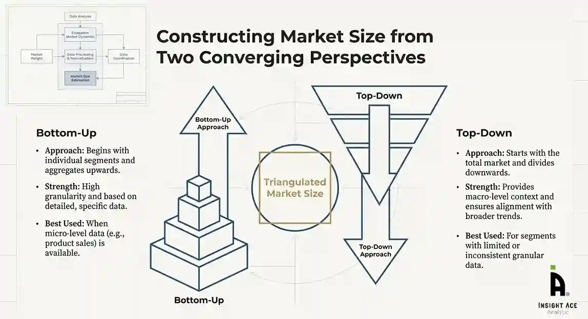
The bottom-up approach involved aggregating segment-level data, such as:
This method was primarily used when detailed micro-level market data were available.

The top-down approach used macro-level indicators:
This approach was used for segments where granular data were limited or inconsistent.
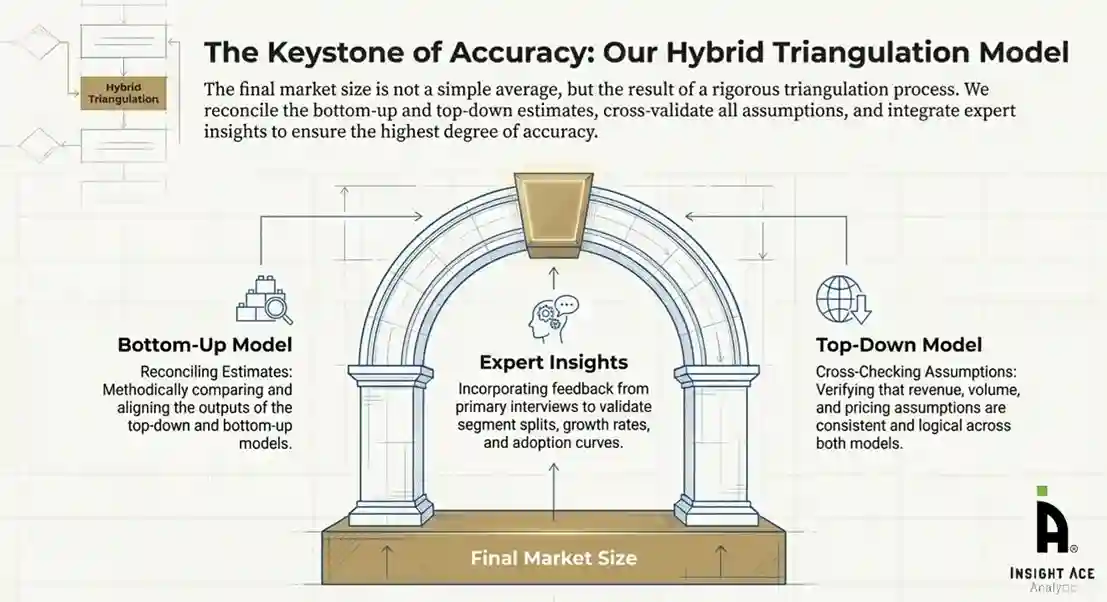
To ensure accuracy, a triangulated hybrid model was used. This included:
This multi-angle validation yielded the final market size.
Market forecasts were developed using a combination of time-series modelling, adoption curve analysis, and driver-based forecasting tools.
Given inherent uncertainties, three scenarios were constructed:
Sensitivity testing was conducted on key variables, including pricing, demand elasticity, and regional adoption.